Define your operating window
ICS-GEO: range, interface and error budget.
- Axes & range
- Horizontal / vertical tilt beams; network architecture reviewed per installation.
- Performance request
- Accuracy target ±0.005° ≈ 0.087 mm/m; not a direct guarantee of displacement or settlement accuracy.
- Output interface
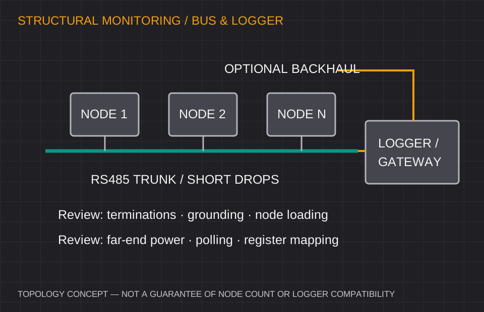
- RS485 Modbus RTU; LoRa options subject to local radio requirements.
- Installation environment
- IP68 stainless-steel option — immersion depth and duration must be defined.
Values are selection targets for quotation. Model-specific test conditions, calibration and released specifications govern acceptance.
Where this configuration fits
Bridge deflection, wind towers, tunnel segments, dams and excavation support monitoring.
Before approving the sample
- Up to 128 nodes is a project target; verify transceiver loading, repeaters and power budget.
- Define cable length, shielding, grounding, termination and polling period.
- Settlement or displacement calculations need a validated reference and geometry.
Comparing an existing inclinometer?
Reference families: RST / DGSI fixed in-place tilt systems and Jewell geotechnical instruments. These are evaluation starting points. Confirm exact model, mechanical drawing, electrical behavior and acceptance test before claiming interchangeability.
Review the replacement checklist →